




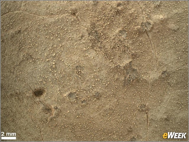
Martian Rock Target
This image from the Mars Hand Lens Imager (MAHLI) on Curiosity shows details of rock texture and color in an area where the rover’s Dust Removal Tool (DRT) brushed away dust that was on the rock.
Dust Removal
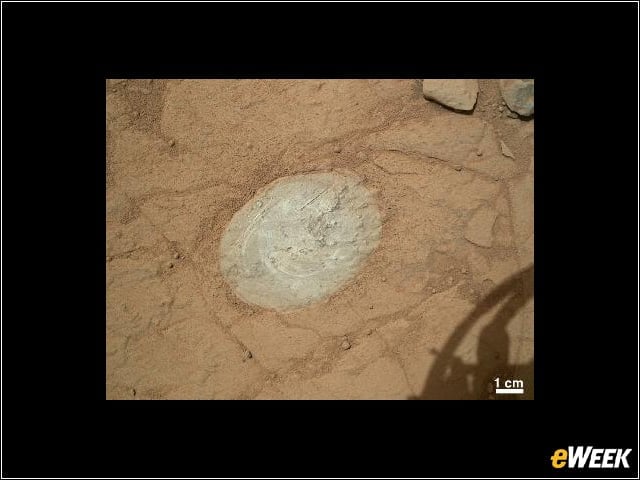
Here we see a patch of rock cleaned by the first use of the DRT, a motorized, wire-bristle brush on the turret at the end of the rover’s arm.
Veins and Concretions
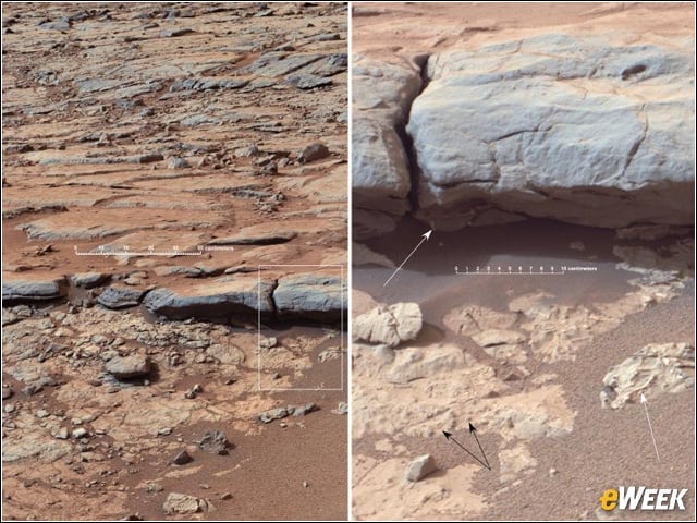
The right Mast Camera (Mastcam) of Curiosity provided this view of the lower stratigraphy at “Yellowknife Bay” inside Mar’s Gale Crater.
Evidence of Stream Flow
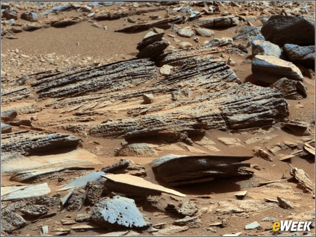
This image shows inclined layering known as cross-bedding in an outcrop called “Shaler” where it appears that currents molded the sediments into small underwater dunes that migrate downstream.
Drilling Debut
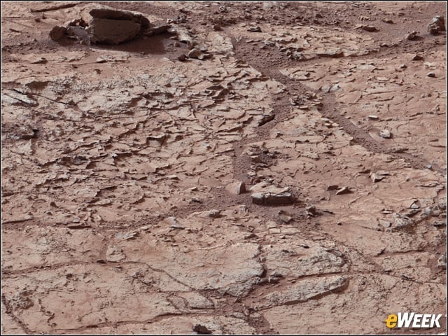
This patch of veined, flat rock was selected as the first drilling site for Curiosity. It is shot full of fractures and veins, with the intervening rock also containing small concentrations of minerals, which makes it interesting to geologists back on Earth.
Veins in Sheepbed Outcrop
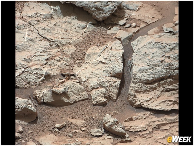
Geologists say these veins form when water circulates through fractures, depositing minerals along the sides of the fracture, to form a vein.
Spherules in Yellowknife Bay
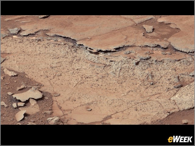
These features are interpreted as concretions, implying they formed in water that percolated through pores in the sediment. Spherical concretions have previously been discovered in other rocks on Mars.
Curiosity’s Traverse
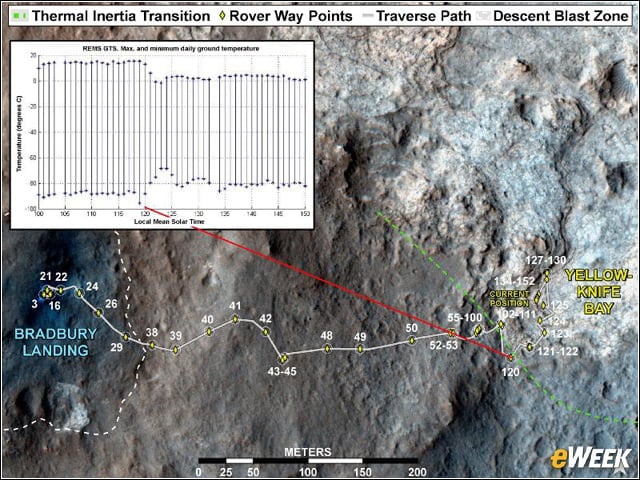
This image maps the route of Curiosity from Bradbury Landing to Yellowknife Bay, with an inset documenting a change in the ground’s thermal properties with arrival at a different type of terrain.
Snake River
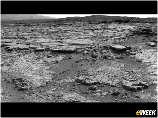
The sinuous rock feature in the lower center of this mosaic of images recorded by Curiosity is called Snake River. The rover drove about 10 feet to get a closer look at Snake River for before proceeding to other nearby rocks.
Self Portrait
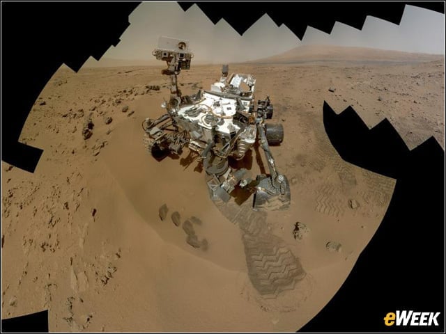
Curiosity used the Mars Hand Lens Imager (MAHLI) to capture dozens of high-resolution images to be combined into self-portrait images of the rover.