


How Technology Sped Minnesota Bridge’s Rebirth

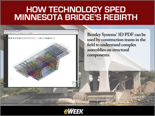
Bentley Systems’ 3D PDF can be used by construction teams in the field to understand complex assemblies on structural components.
No Title
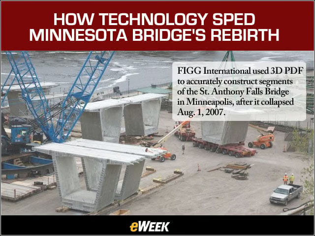
FIGG International used 3D PDF to accurately construct segments of the St. Anthony Falls Bridge in Minneapolis, after it collapsed Aug. 1, 2007.
No Title
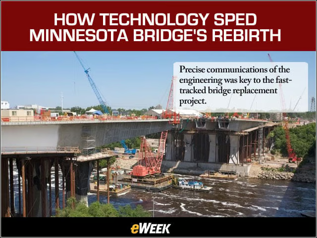
Precise communications of the engineering was key to the fast-tracked bridge replacement project.
No Title
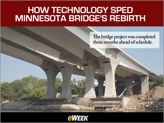
The bridge project was completed three months ahead of schedule.
No Title
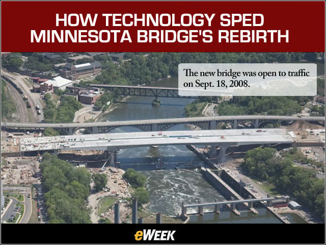
The new bridge was open to traffic on Sept. 18, 2008.
No Title
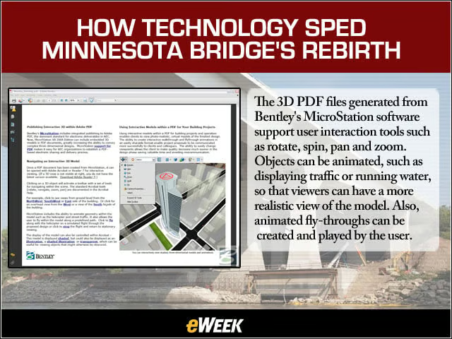
The 3D PDF files generated from Bentley’s MicroStation software support user interaction tools such as rotate, spin, pan and zoom. Objects can be animated, such as displaying traffic or running water, so that viewers can have a more realistic view of the model. Also, animated fly-throughs can be created and played by the user.
No Title
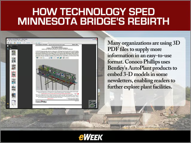
Many organizations are using 3D PDF files to supply more information in an easy-to-use format. Conoco Phillips uses Bentley’s AutoPlant products to embed 3-D models in some newsletters, enabling readers to further explore plant facilities.
No Title
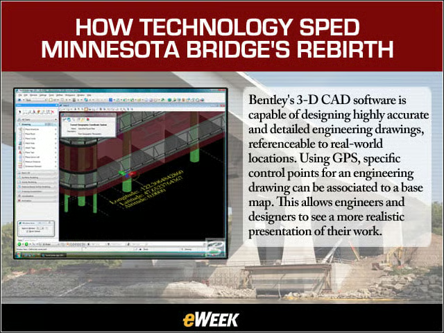
Bentley’s 3-D CAD software is capable of designing highly accurate and detailed engineering drawings, referenceable to real-world locations. Using GPS, specific control points for an engineering drawing can be associated to a base map. This allows engineers and designers to see a more realistic presentation of their work.
No Title
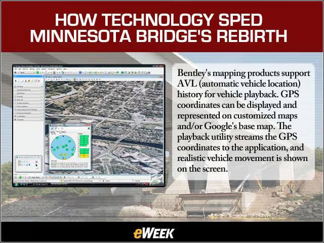
Bentley’s mapping products support AVL (automatic vehicle location) history for vehicle playback. GPS coordinates can be displayed and represented on customized maps and/or Google’s base map. The playback utility streams the GPS coordinates to the application, and realistic vehicle movement is shown on the screen.
No Title
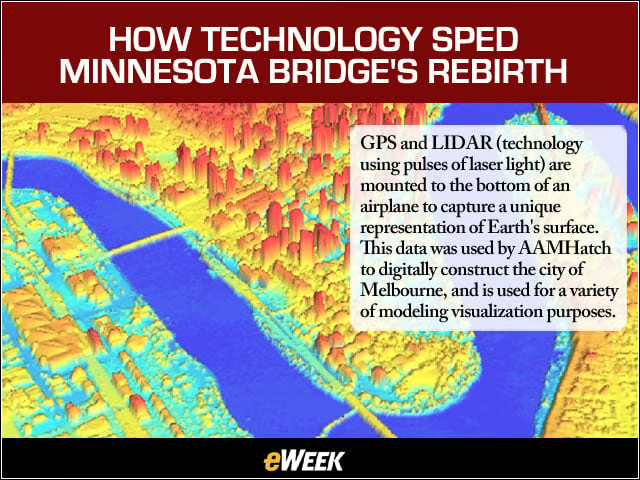
GPS and LIDAR (technology using pulses of laser light) are mounted to the bottom of an airplane to capture a unique representation of Earth’s surface. This data was used by AAMHatch to digitally construct the city of Melbourne, and is used for a variety of modeling visualization purposes.
No Title
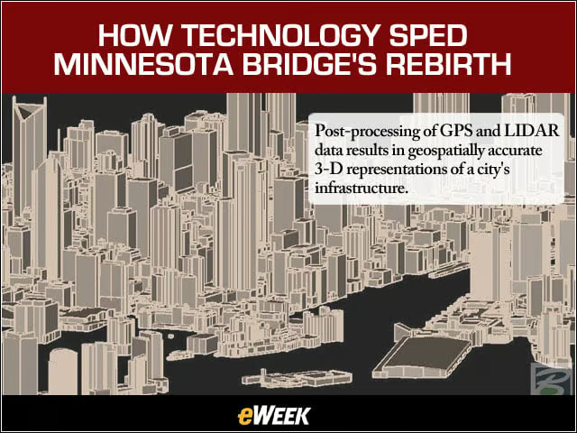
Post-processing of GPS and LIDAR data results in geospatially accurate 3-D representations of a city’s infrastructure.
No Title
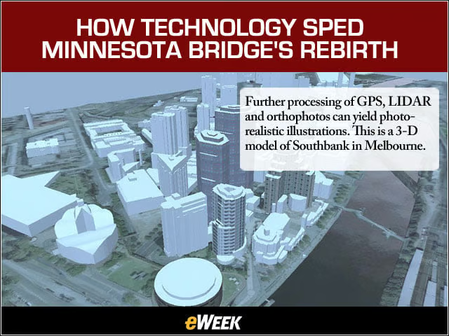
Further processing of GPS, LIDAR and orthophotos can yield photorealistic illustrations. This is a 3-D model of Southbank in Melbourne.