


- GPS software comparison
- GPS software comparison – GPS 2. – MapTech Terrain Navigator Pro
- GPS software comparison – GPS 3. – MapTech Terrain Navigator Pro
- GPS software comparison – GPS 4. – MapTech Terrain Navigator Pro
- GPS software comparison – GPS 5. – MapTech Terrain Navigator Pro
- GPS software comparison – GPS 6. – Microsoft Streets & Trips
- GPS software comparison – GPS 7. – MapTech Terrain Navigator Pro
- GPS software comparison – GPS 8. – MapTech Terrain Navigator Pro
- GPS software comparison – GPS 9. – MapTech Terrain Navigator Pro
- GPS software comparison – GPS 10. – DeLorme Topo USA 5.0
GPS software comparison
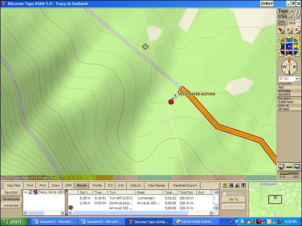
This is a close-in view of the nest location as seen in DeLorme Topo USA 5.0. Yes, the nest is on the south side of a road, but which road? DeLorme never says. Note the turn-by-turn directions in the box below the map.
GPS software comparison – GPS 2. – MapTech Terrain Navigator Pro
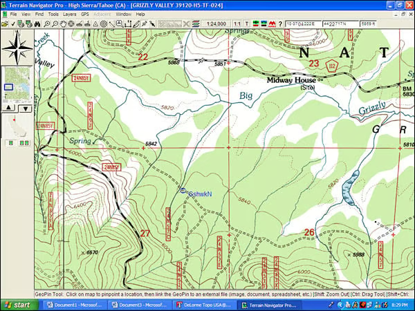
2. This is a USGS topographic map as displayed by MapTech Terrain Navigator Pro. Note the level of detail and in the red vertical boxes the designations of the forest roads. The nest, marked with blue text, is on road 24N57.
GPS software comparison – GPS 3. – MapTech Terrain Navigator Pro

3. This is an aerial view of the nest location, again marked in blue, which I should have made larger and bold.
GPS software comparison – GPS 4. – MapTech Terrain Navigator Pro
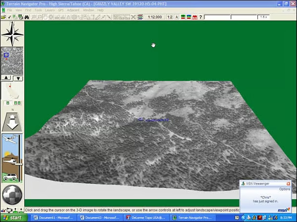
3. Here?s the aerial projected in 3D. My friend Chris says hello.
GPS software comparison – GPS 5. – MapTech Terrain Navigator Pro
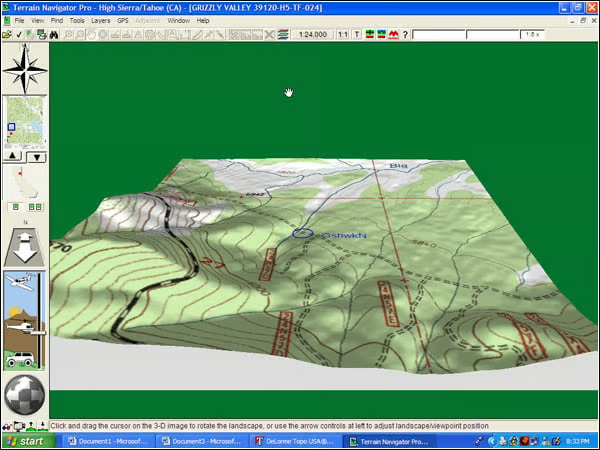
Heres the topo map in 3D.
GPS software comparison – GPS 6. – Microsoft Streets & Trips
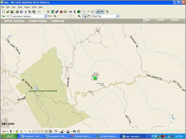
5. I mentioned the value of elevation data. Heres Mt. Hamilton as shown by Microsoft Streets & Trips. Actually, this is from MapPoint but the maps are the same.
GPS software comparison – GPS 7. – MapTech Terrain Navigator Pro
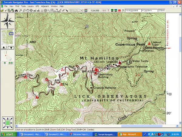
Now heres the topo of Mt. Hamilton from Terrain Navigator Pro. Looks very different.
GPS software comparison – GPS 8. – MapTech Terrain Navigator Pro
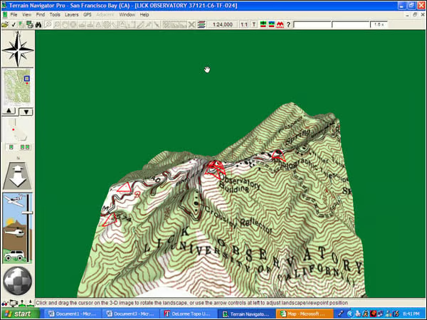
And to emphasize the point, heres the topo in 3D. This is VERY different than the Microsoft map.
GPS software comparison – GPS 9. – MapTech Terrain Navigator Pro
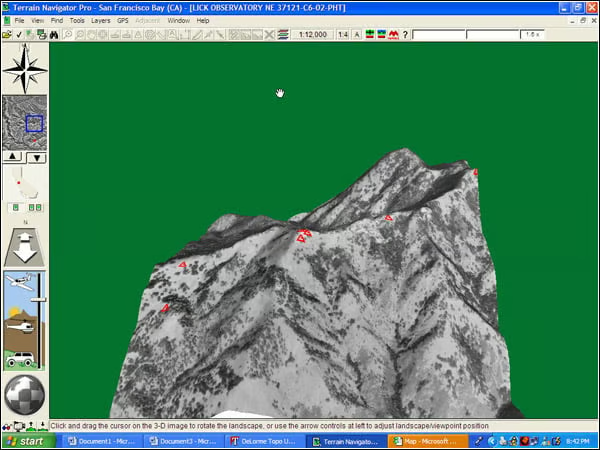
Heres Mt. Hamilton as seen in an aerial photo, projected into 3D.
GPS software comparison – GPS 10. – DeLorme Topo USA 5.0
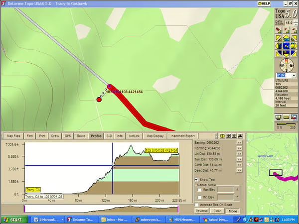
Heres the Topo USA map again, but with a route profile replacing the turn-by-turn information. We gained some altitude on this trip.