Close
  • Latest News
  • Artificial Intelligence
  • Video
  • Big Data and Analytics
  • Cloud
  • Networking
  • Cybersecurity
  • Applications
  • IT Management
  • Storage
  • Sponsored
  • Mobile
  • Small Business
  • Development
  • Database
  • Servers
  • Android
  • Apple
  • Innovation
  • Blogs
  • PC Hardware
  • Reviews
  • Search Engines
  • Virtualization
Read Down
Sign in
Close
Welcome!Log into your account
Forgot your password?
Read Down
Password recovery
Recover your password
Close
Search
Logo
Logo
  • Latest News
  • Artificial Intelligence
  • Video
  • Big Data and Analytics
  • Cloud
  • Networking
  • Cybersecurity
  • Applications
  • IT Management
  • Storage
  • Sponsored
  • Mobile
  • Small Business
  • Development
  • Database
  • Servers
  • Android
  • Apple
  • Innovation
  • Blogs
  • PC Hardware
  • Reviews
  • Search Engines
  • Virtualization
More
    Home Applications
    • Applications

    Five Things You Didn’t Know GIS Could Do

    By
    Darryl K. Taft
    -
    April 7, 2015
    Share
    Facebook
    Twitter
    Linkedin

      eWEEK content and product recommendations are editorially independent. We may make money when you click on links to our partners. Learn More.

      PrevNext

      1Five Things You Didn’t Know GIS Could Do

      1 - Five Things You Didn't Know GIS Could Do

      by Darryl K. Taft

      2Fuel Your Coffee Fix

      2 - Fuel Your Coffee Fix

      Notice a new Starbucks on your block? It wasn’t placed there randomly. The company uses a market planning and store development application powered by GIS called Atlas that helps it grow in a sustainable way. Using Atlas, Starbucks is able to evaluate local commerce hubs, retail clusters, demographics, traffic and transportation nodes to identify the optimal sites for new locations. Atlas also helps tailor the placement of Starbucks products such as its upscale Clover brewing system and imminent wine and beer offerings by analyzing customers’ spending habits in a particular location.

      3Help Stop the Spread of Ebola

      3 - Help Stop the Spread of Ebola

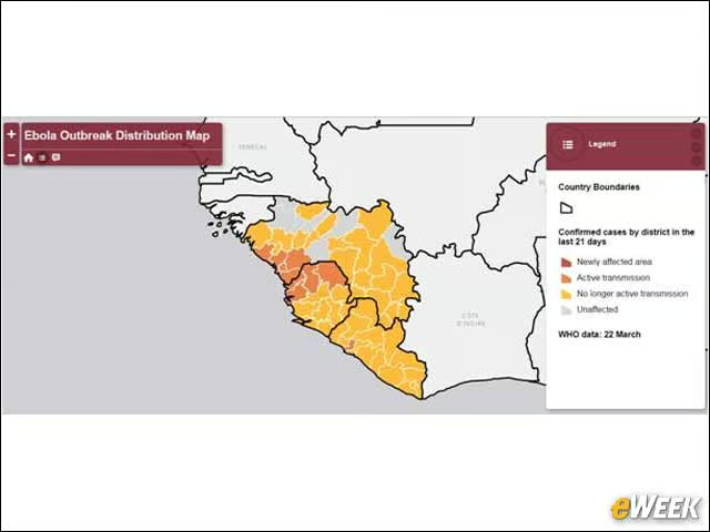
      At the height of the Ebola outbreak in West Africa in 2014, GIS mapping technology solutions provider Esri partnered with the World Health Organization to track and analyze the number of people infected, and to try to prevent the virus from being spread that way. In addition, the software enabled agencies to locate Ebola treatment centers and identify where they are being planned for the future. The technology was able to identify potential new outbreaks by using cell phone data, enabling public health and medical professionals to access and treat the population sooner.

      4Improve the Process From A to B

      4 - Improve the Process From A to B

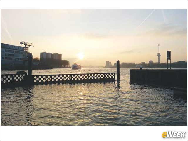
      As global population expands and infrastructure ages, engineers, urban planners and many more who work to optimize the transportation of goods and people have turned to GIS. From expanding and rejuvenating Europe’s largest and most important port to modeling options for future transportation infrastructure, sophisticated mapping technology is helping officials make better decisions about the ways in which people and things are moved.

      5Drive STEM Education

      5 - Drive STEM Education

      It’s not just college students who use ArcGIS, Esri’s GIS. Esri sees applied geography services and solutions taking a front seat in the drive toward promoting STEM education at all levels, which is why it committed $1 billion as part of President Obama’s ConnectED initiative to offer its technology to every K-12 school in the United States. At Bow High School in Bow, N.H., students used GIS technology to create a mapping app that shows people where trash is around the town forests. The data is shared on a collective map accessed by local community service groups, who clean and mark the site.

      6Help Combat Global Climate Change

      6 - Help Combat Global Climate Change

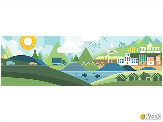
      In a partnership with the White House Climate Data Initiative, geospatial technology and expertise is being used to help cities like New Orleans plan for the effects of global climate change. By taking data directly from the National Oceanographic and Atmospheric Institute and the U.S. Geological Survey, Esri can provide tools that can bring climate change information to life—such as an application showing the impact of a 1-meter sea level rise in New Orleans—that can in turn empower state, local and private-sector organizations to take actions to reduce greenhouse gas emissions.

      PrevNext

      Get the Free Newsletter!

      Subscribe to Daily Tech Insider for top news, trends & analysis

      MOST POPULAR ARTICLES

      Artificial Intelligence

      9 Best AI 3D Generators You Need...

      Sam Rinko - June 25, 2024 0
      AI 3D Generators are powerful tools for many different industries. Discover the best AI 3D Generators, and learn which is best for your specific use case.
      Read more
      Cloud

      RingCentral Expands Its Collaboration Platform

      Zeus Kerravala - November 22, 2023 0
      RingCentral adds AI-enabled contact center and hybrid event products to its suite of collaboration services.
      Read more
      Artificial Intelligence

      8 Best AI Data Analytics Software &...

      Aminu Abdullahi - January 18, 2024 0
      Learn the top AI data analytics software to use. Compare AI data analytics solutions & features to make the best choice for your business.
      Read more
      Latest News

      Zeus Kerravala on Networking: Multicloud, 5G, and...

      James Maguire - December 16, 2022 0
      I spoke with Zeus Kerravala, industry analyst at ZK Research, about the rapid changes in enterprise networking, as tech advances and digital transformation prompt...
      Read more
      Video

      Datadog President Amit Agarwal on Trends in...

      James Maguire - November 11, 2022 0
      I spoke with Amit Agarwal, President of Datadog, about infrastructure observability, from current trends to key challenges to the future of this rapidly growing...
      Read more
      Logo

      eWeek has the latest technology news and analysis, buying guides, and product reviews for IT professionals and technology buyers. The site’s focus is on innovative solutions and covering in-depth technical content. eWeek stays on the cutting edge of technology news and IT trends through interviews and expert analysis. Gain insight from top innovators and thought leaders in the fields of IT, business, enterprise software, startups, and more.

      Facebook
      Linkedin
      RSS
      Twitter
      Youtube

      Advertisers

      Advertise with TechnologyAdvice on eWeek and our other IT-focused platforms.

      Advertise with Us

      Menu

      • About eWeek
      • Subscribe to our Newsletter
      • Latest News

      Our Brands

      • Privacy Policy
      • Terms
      • About
      • Contact
      • Advertise
      • Sitemap
      • California – Do Not Sell My Information

      Property of TechnologyAdvice.
      © 2024 TechnologyAdvice. All Rights Reserved

      Advertiser Disclosure: Some of the products that appear on this site are from companies from which TechnologyAdvice receives compensation. This compensation may impact how and where products appear on this site including, for example, the order in which they appear. TechnologyAdvice does not include all companies or all types of products available in the marketplace.

      ×