1Google Earth Tracks Gulf Oil Spill; Creates Crisis Response Site
by Clint Boulton
2Deepwater Horizon Explosion
Besides killing and injuring drilling platform workers, the resulting oil spill is causing incalculable damage to marine life and threatens to pollute hundreds of miles of Gulf Coast beaches and wetlands. This shot, taken from Wikimedia Commons, spells out the disaster.
3The Oil Spill Over Time
Google uses satellite imagery in Google Earth to chart the Deepwater spill’s progression over a week.
4Google Earth Layer Tracks the Spill
Google Earth users may turn on the Places of Interest layer in the Layers panel on the left-hand side of Google Earth, navigate to the Gulf of Mexico and click on the red icon to see the imagery.
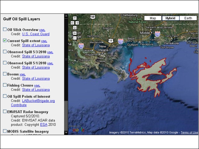
5Crisis Response Center
Google offers this Crisis Response Center to help users gather more information about the catastrophe. Note the current extent of the spill.
6May 3: The Oil Slick Expands
The path of the oil spill on May 3. Note how much more concentrated it is compared to the spill path on May 5, as the oil has spread out.
7May 1: Oil Spill Volume Steadily Grows
The spill’s circumference is tighter still on May 1.
8Fishing Shut Down
See where the U.S. Coast Guard shut down fishing, the bread and butter of many Gulf Coast families.
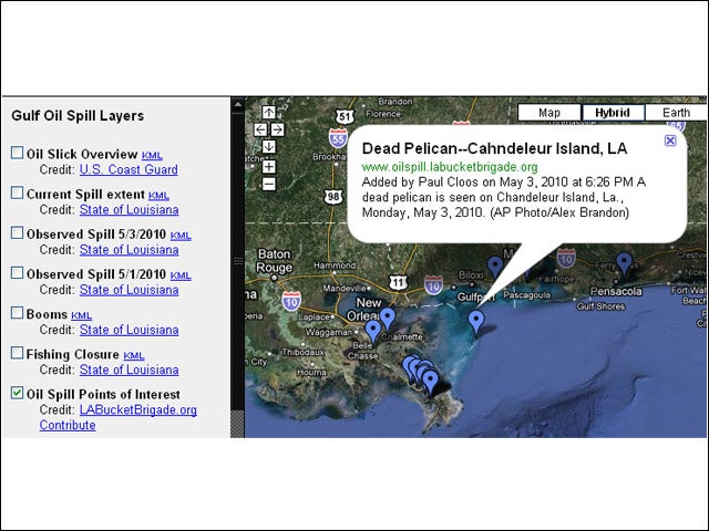
9Points of Interest
A fourth generation shrimper based out of Venice, La. describes how he and his family lost this year’s brown shrimp season due to the spill.
10Satellite Imagery
This NASA satellite imagery shows the first day of the spill one day after the Deepwater Horizon oil rig sank.
11Google Grabs Wikipedia
Google overlays the Wikipedia entry on Deepwater Horizon on its Google Earth imagery of the spill.
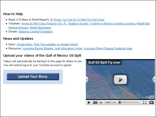
12How to Help
Here are the links to more information on the disaster, as well as how to help and send relief. This video shows a flyover of the disaster site. Users may upload their own oil spill disaster videos on YouTube from here, too.
AI 3D Generators are powerful tools for many different industries. Discover the best AI 3D Generators, and learn which is best for your specific use case.
I spoke with Zeus Kerravala, industry analyst at ZK Research, about the rapid changes in enterprise networking, as tech advances and digital transformation prompt...
I spoke with Amit Agarwal, President of Datadog, about infrastructure observability, from current trends to key challenges to the future of this rapidly growing...