1Google Leans on GeoEye-1 Satellite for Celestial Views
by Clint Boulton
2GeoEye
GeoEye is the company that makes the satellites that help Google Earth and Google Maps chart the world from space.
3GeoEye-1
GeoEye launched GeoEye-1 in September 2008, with Google joining as a partner not long after to use the satellite’s imagery.
4GeoEye-1 Spies Pyramids in Egypt
In March 2009, Google unveiled its partnership with GeoEye, promising that “you will start seeing stunning GeoEye-1 imagery blended into our database and viewable through Google Earth, Maps and Google Maps for Mobile.”
5GeoEye-1 Captures the Inauguration
Last week, Google served up this and other presidential inauguration images.
6Google Haiti
Google and GeoEye-1 capture how Port-au-Prince was leveled by the force 7.0 earthquake.
7GeoEye Featured Imagery Layer in Google Earth
The new “GeoEye Featured Imagery” layer in Google Earth features placemarks, including a thumbnail of the image, a link to view the image in full resolution and information about the scene, including resolution, collection date and a narrative about the location.
8Geo-Las Vegas
Google offers some favorite featured imagery pics from GeoEye-1, beginning with Las Vegas.
9Oh, Canada
GeoEye-1 tracks Vancouver, British Columbia.
10Mount Kilimanjaro
This is a view of Mount Kilimanjaro, the notorious mountain that has claimed the lives of many who tried to conquer it.
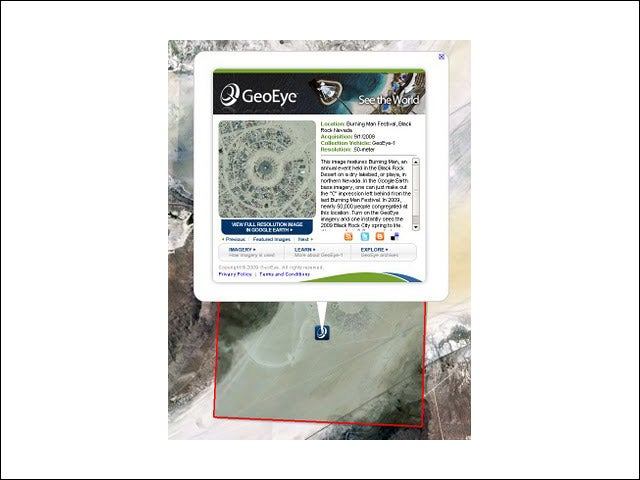
11Burning Man Festival
On the lighter, social side, Google also enlists GeoEye-1 for event images from the heavens.
12Google Earth and GeoEye-1
Google invites users to download Google Earth to see their own GeoEye-1 satellite images here.
AI 3D Generators are powerful tools for many different industries. Discover the best AI 3D Generators, and learn which is best for your specific use case.
I spoke with Zeus Kerravala, industry analyst at ZK Research, about the rapid changes in enterprise networking, as tech advances and digital transformation prompt...
I spoke with Amit Agarwal, President of Datadog, about infrastructure observability, from current trends to key challenges to the future of this rapidly growing...