


Google Earth Reveals Haiti Earthquake Devastation

by Nicholas Kolakowski
No Title
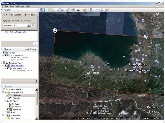
Google has been working with GeoEye to make the satellite-imagery companys latest orbital photos of Port-au-Prince available to Google Earth.
No Title
Googles images of Port-au-Prince were snapped at 10:27 a.m. on Jan. 13.
No Title
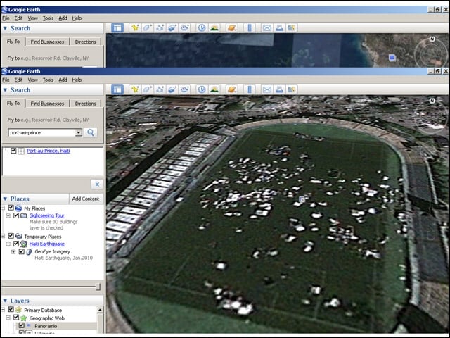
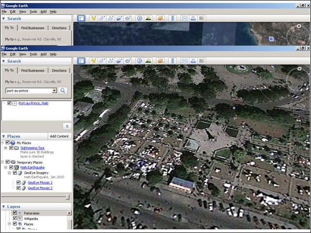
In these images, one can see how sites like a sports stadium have become camps for refugees.
No Title
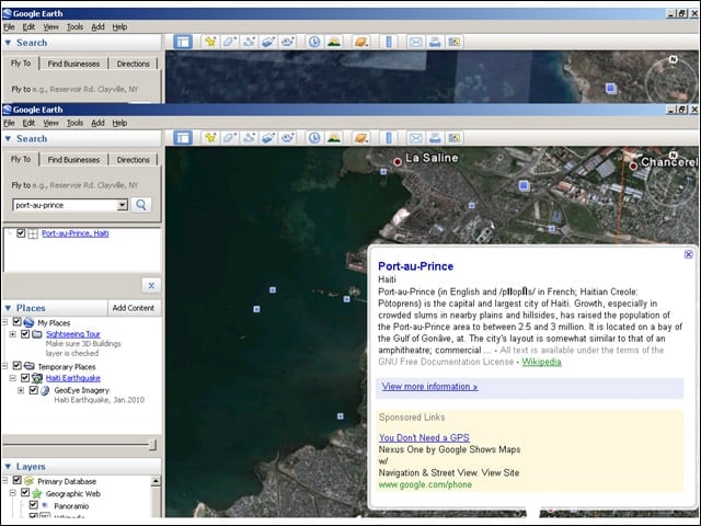
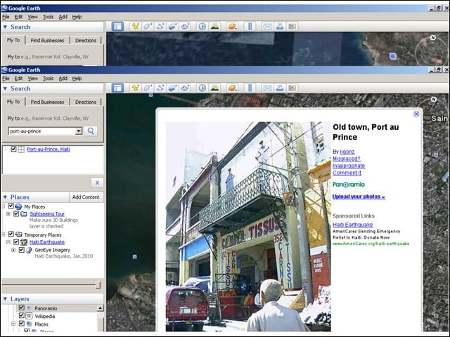
Google Earth also features in-application links to Wikipedia entries on local landmarks.
No Title
Google Earth includes links to pre-earthquake images of Haiti. Presumably, future updates could feature photos of earthquake devastation.
No Title
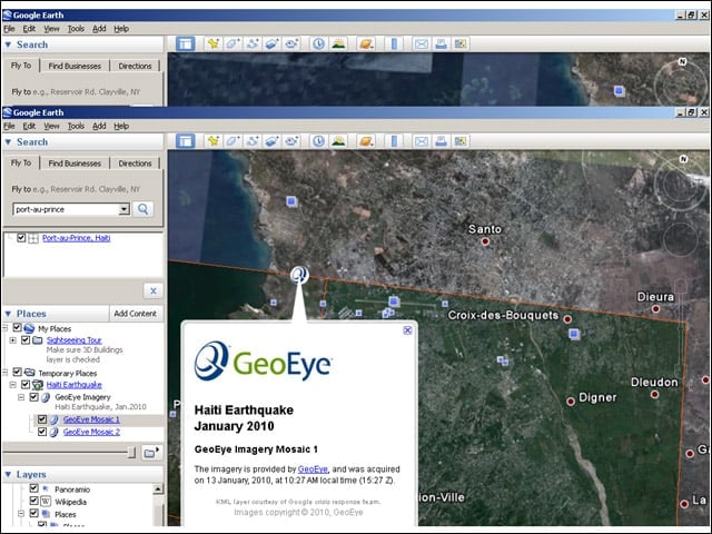
GeoEyes satellite imagery of Port-au-Prince is also available on Google Maps.
No Title
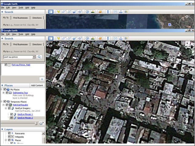
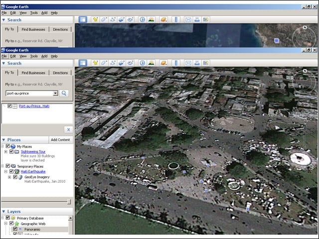
Googles Haiti images are high-resolution enough to show building devastation.
No Title
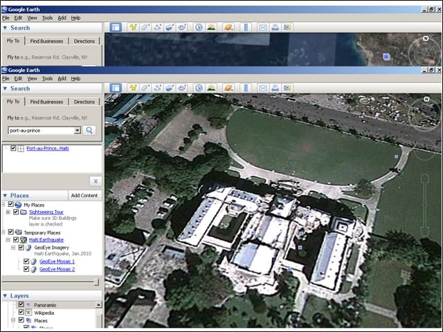
The presidential palace in Port-au-Prince was wrecked by the earthquake, as can be seen here.
No Title
Satellite images revealed devastation throughout the city.
No Title
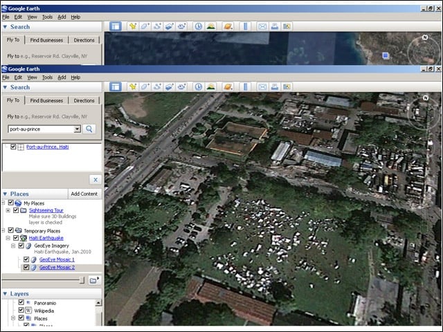
As time goes on, future Haiti updates to Google Earth may reveal more makeshift camps growing in open areas.
