


We’ve said it here in eWEEK before and we’ll say it again: More data is being generated by more devices and their users than ever, and much of it is location-based. In fact, the geospatial data market is expected to grow to $73.9 billion by 2021, up from $30.7 billion in 2016.
Spatial data refers to all types of data objects or elements that are present in a geographical space or horizon. It enables the global finding and locating of individuals or devices anywhere in the world. Spatial data is also known as geospatial data, spatial information or geographic information.
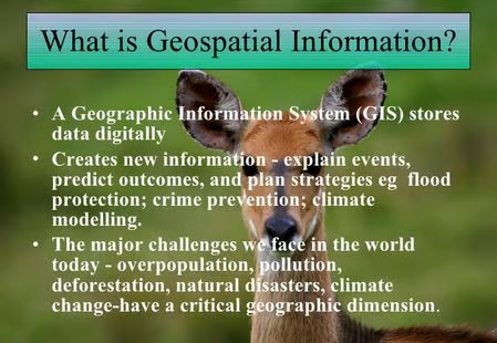
[To see a larger version of the image at upper left, right-click on it and select “View Image.”]
In order to make critical decisions and fuel important processes, enterprises need to be able to access and make sense of this data quickly and with minimal hassle. As a result, geospatial information system (GIS) solutions, which make sense of location-aware data and turn it into usable insights, are driving major disruptions across multiple sectors.
In this eWEEK Data Point article, Anthony Calamito, Chief Geospatial Officer at Boundless, offers our readers his industry expertise to explain how GIS technology is transforming agriculture, transportation, energy, retail, defense, federal government and state and local government. Boundless is a St. Louis, Mo.-based provider of open source product support, training and core development to meet geospatial requirements.
Data Point No. 1: Agriculture
Each growing season, farmers might make as many as 50 key decisions–about what crop to grow, when to plant, whether or not to use fertilizer and so on. Any of these can end up affecting crop yield, as well as the bottom line.In the past, farmers made these important decisions based on historical patterns, tradition or even by talking shop with neighboring growers and other people in the know. Today, agricultural operations generate more location-based data than almost any other industry, with data flowing from a number of sources. These can include machine telemetry, weather stations and ground sensors, soil samples, ground observations and satellites and drones. With GIS, agriculture companies can collect, maintain and analyze data to maximize resources, monitor crop health and safety and improve yield.
Data Point No. 2: Transportation and logistics
Moving people and things around often involves enormous logistical challenges. Consider a hospital that wants to provide its patients with the best and fastest route to their facilities at a particular moment, a municipal government that wants to establish optimal bus and light rail routes, a manufacturer that wants to ship its products as efficiently and cost-effectively as possible, or an oil company that wants to plan its pipeline locations. In each of these scenarios, the analysis of location-based data is vital in making informed business decisions.
Data Point No. 3: Energy
Energy exploration is a highly spatial enterprise, with data from satellite images, surface geology mapping and subsurface remote sensing determining the economic viability of pursuing operations in a certain site. Energy and utility companies are dealing with massive proliferation of geographical data, because industrial sensors are now everywhere–from airborne-mounted lasers to surface data sensors during drilling to pipelines monitors. Mapping and spatial analytics provide the necessary insight for making decisions that help achieve compliance, ensure accurate site selection and locate resources.
Data Point No. 4: Retail
As consumer reliance on smartphones accelerates and wearables become more common, brick-and-mortar retailers can use geospatial technology to get a better picture of customer behavior, both past and present. This is because geospatial data goes beyond location–the geometry of a point on a map–to include attribution about those geometries, such as customer demographics or where people spend the most time within stores. All of this data can be used to inform decisions on store locations, merchandise mix and arrangements and other aspects of the customer experience.
Data Point No. 5: Defense and intelligence operations
Geospatial technology has changed defense and intelligence operations in every part of the world, wherever military personnel are deployed. Defense leaders, analysts and other staff rely on accurate GIS data to carry out mission-critical activities strategically and successfully, with efficient collaboration across all phases of planning and operational activities. GIS aids situational assessment (provides complete visual displays of tactical information to personnel in command or in the field), land operations (reveals terrain conditions, elevations, routes, vegetation cover, facilities and population centers), air operations (conveys weather and visibility data to pilots; guides troops, supplies and targeting) and maritime operations (reveals currents, wave conditions, tides and weather).
Data Point No. 6: Federal government
Timely and accurate geospatial intelligence is critical for federal agencies making decisions that impact safety and security, infrastructure, resource management and quality of life. GIS enables safety and security efforts withoperational support and coordination for defense, disaster response, law enforcement, national security and first responder services. Regarding infrastructure, GIS helpsmanage resources and assets for highways, ports, public transportation and airports. Federal agencies are also using GIS to betterunderstand current and historical data for the management of agriculture, forestry, mining, water and other natural resources.
Data Point No. 7: State and local government
State and local governments make daily decisions that directly affect residents and visitors. From operations such a pothole repair and utility operations to land value assessments and property development, mapping applications are used to analyze and interpret GIS data to enable these critical decisions. Additionally, the population and landscape of cities and towns can change dramatically in relatively short periods of time. To adapt to these changes and offer the level of service people have come to expect in their day-to-day lives, state and local governments are embracing modern GIS technology for a variety of essential applications, including traffic and road conditions, environmental quality, disease outbreaks, utility distribution (i.e. electricity, water, and sewer systems), managing parks and other public land and permitting (for camping, hunting, boating, etc.).